Zurich, Switzerland · Nature & viewpoints

Uetliberg

Plan a Uetliberg outing for Zurich’s hilltop landscape, weather-dependent views and walking routes, including the dated 2026 S10 disruption.

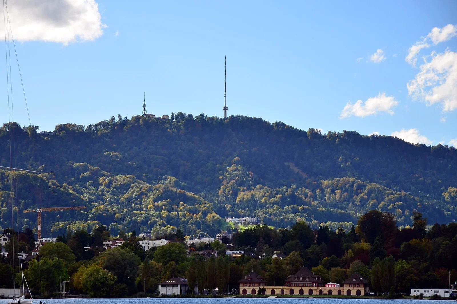
The wooded Uetliberg ridge and summit mast seen across water from Zurich.Uetliberg summit area, Zurich region. Approximate subject marker, not a guaranteed accessible or ticket-holder entrance.
“Uetliberg - Wollishofen - Zürichhorn 2012-09-27 16-15-12.JPG”. The wooded Uetliberg ridge and summit mast seen across water from Zurich. Taken 27 September 2012. View towards Uetliberg from Zurich, not a view from the summit. This dated photograph does not establish current access or site conditions. Photo by roland zh / Wikimedia Commons / CC BY-SA 3.0. Resized and converted to WebP; covers and cards may crop. / Wikimedia Commons · CC BY-SA 3.0 · Cropped for display; converted to WebP.
WHY IT MATTERS

Why this place matters.

Uetliberg changes the scale of a Zurich visit. From the Old Town, the city can feel like a sequence of streets, bridges and entrances; a hill outing invites you to understand the wider landscape instead. Choose it for the weather and the walk you actually want, rather than as an obligatory photograph between museum bookings.

Place typeNature & viewpoints
THE STORY BEHIND THE PLACE

How this place came to be.

Understand the place

Uetliberg is Zurich’s local mountain and a longstanding point from which to understand the city’s relationship with its lake and surrounding hills. The landscape, rather than a single building interior, is the subject of this visit.

LOOK A LITTLE CLOSER

What to notice.

  1. 01

    What to look for

    Choose between a short summit-area outing and a longer walk according to conditions and ability. Views towards the lake and Alps depend on visibility. The guide photo looks towards the mountain from Zurich, not out from the summit.

BEFORE YOU GO

Make your visit count.

Prepare your visit

Dated check, 31 October 2026: SZU announces the HB–Selnau closure through 12 December 2026, with reopening planned for 13 December. Consult its notice and the live ZVV journey planner for the S10 connection. Check weather, daylight, paths and return travel; do not assume winter trails are safe or that all viewpoint facilities are open.

Make a realistic connection

Leave time for arriving, finding the correct entrance, the visit itself and a pause afterwards. Choose an onward stop according to geography and remaining energy rather than a target number of attractions.

Official hours & tickets
FIND YOUR WAY

Find Uetliberg.

Uetliberg summit area, Zurich region. Approximate subject marker, not a guaranteed accessible or ticket-holder entrance.

Use the current ZVV timetable and SZU S10 notices. The HB–Selnau closure is announced through 12 December 2026; plan the connection to Selnau and the final outdoor approach.

Open location in Google Maps The marker identifies the monument area. Follow the entrance shown on your booking.
CONNECT THE STORIES

Explore around Uetliberg.

An original AI-assisted guide checked by TourPedia before publication. Visiting arrangements can change; use the official visitor links before travelling.

MAKE YOURSELF AT HOME

Stay near Uetliberg.

A curated collection of places to consider around this area.

Explore nearby stays

Curated hotels for this area are not available yet.

Distances are approximate straight-line measurements from the Uetlibergarea marker, not walking routes. This is a small researched collection, not all nearby hotels. Check rates and availability on the hotel website.

A TASTE OF THE NEIGHBORHOOD

Where to eat near Uetliberg.

Find a meal that fits your visit, with official contact links.

Explore nearby food

Curated dining places for this area are not available yet.

A small researched collection, not all nearby restaurants. Confirm menus, opening hours and reservations with the restaurant.

GO BEYOND THE POSTCARD

A closer look at Zurich.

A little context. A new perspective. Somewhere worth knowing.

View all stories