Maine Coast: Lighthouses, Harbor Towns and Acadia
Explore Maine through Portland Head Light, Camden and Acadia, with a flexible coastal route, real landscape photography and practical seasonal planning.
- Compare two lighthouse settings at Cape Elizabeth and Bass Harbor.
- Connect Camden harbor with the view over Penobscot Bay.
- Explore Acadia with separate plans for the coast, Jordan Pond and seasonal access.
Maine's coast is most rewarding when you stop treating it as scenery between overnight stays. A lighthouse can be a lesson in the shape of the shore; a harbor can reveal how a town meets the water; a lake in Acadia can change the whole pace of a day. The connections matter as much as the names on the map.
This first-visit route uses Portland and Cape Elizabeth, Camden and Mount Desert Island as three anchors. It is a coastal selection within the state of Maine, not a survey of every region or a timed itinerary. Choose the sections that fit your interests and season, then give the places you keep enough time to become more than photographs.
Build the trip around three different bases
A map of Maine can make the coast look like a line. A visit works better as a sequence of places with different rhythms: Portland and Cape Elizabeth for an urban-and-lighthouse beginning, Camden for a harbor and a higher viewpoint, then Mount Desert Island for Acadia. These are suggested anchors, not a claim that one road or one day connects every worthwhile stop.
Decide which part matters most before booking consecutive nights. If Acadia is the main reason for travelling, protect time there rather than using it as the final stop after a long day of detours. If towns and waterfront walks appeal more, give the middle of the journey room to breathe. With a short break, choose one area and explore it properly; a smaller route is still a Maine trip.
Keep a transfer day lighter than a day based in one place. Driving, parking, settling into accommodation and finding a meal all take attention. Instead of promising a fixed journey time, check the actual route for your dates and make one optional stop. Treat every additional peninsula or island as a choice with its own return journey.
Start with the sea at Portland Head Light
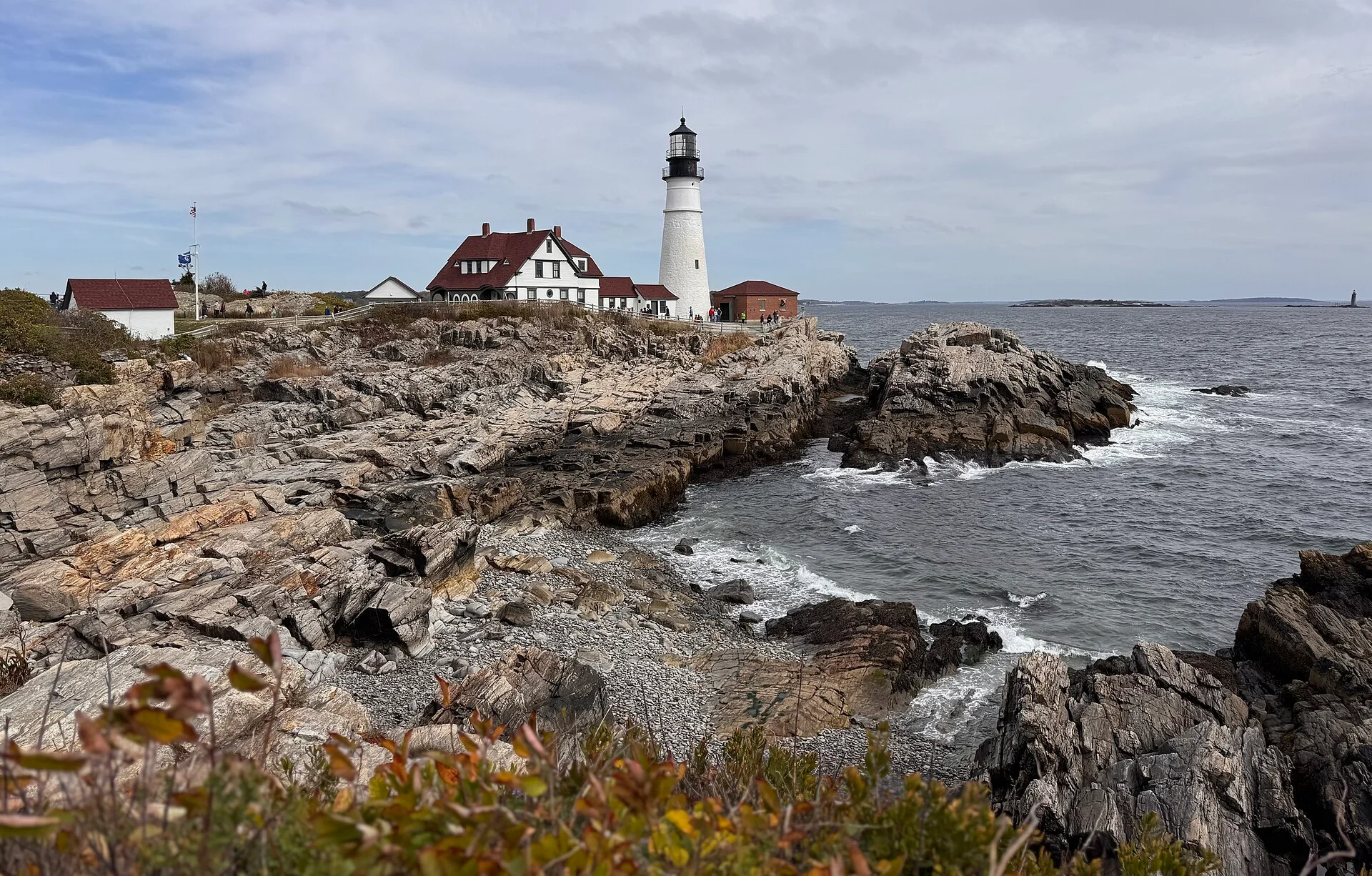
Portland Head Light stands in Cape Elizabeth, outside the city of Portland. Make that distinction when choosing directions. Fort Williams Park provides the wider setting: lawns, former military structures and coastal views give the stop more substance than a photograph of the tower alone. Walk a permitted stretch, look back at the lighthouse and notice how its buildings sit above the broken shoreline.
An exterior visit does not mean that the lighthouse tower is routinely open. The park's official information distinguishes the grounds, parking and museum arrangements; check each rather than treating them as one ticket. Pack out what you bring in under the park's carry-in/carry-out policy. A picnic can be part of the outing, but it should not leave a trace on the lawns or coast.
Use Portland as a contrast in scale and pace rather than a second checklist. Choose a meal or a neighborhood walk that fits the rest of your day, then leave time for the coast. Maine's official accommodation and food directories are useful starting points for checking actual businesses. This guide does not imply that a hotel or restaurant has been personally inspected or that a particular rate is available.
Read Camden from the harbor and the hills
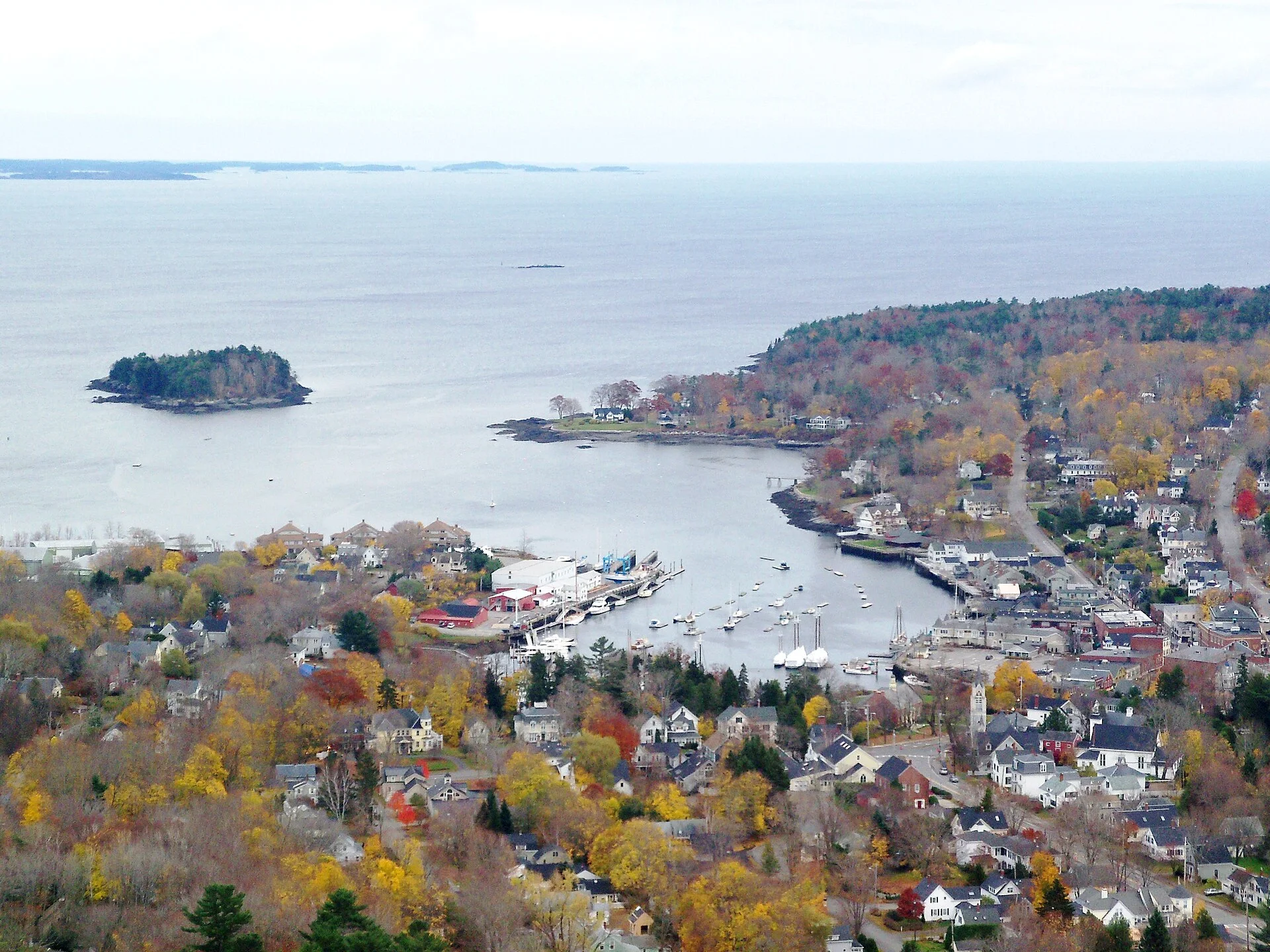
Camden, Rockport and Lincolnville sit along Penobscot Bay. The harbors help make the middle coast feel like a place where people work as well as visit. Look at the relationship between the waterfront, boats and town before seeking another panoramic stop. Keep public access separate from working wharves and private property; an appealing view is not permission to enter.
Camden Hills State Park offers a different perspective over Camden and the bay. Mount Battie is the obvious visual link between the town below and the islands beyond, but decide separately whether to drive when the auto road is available or choose a hike suited to your group. A short trail on a map can still involve steep rock. Check the park's current road and trail information before committing to either option.
The photograph here was made in November 2010. It helps explain the harbor's shape; it cannot tell you what the foliage, weather, boats or road access will be like on your visit. If visibility is poor, let the harbor be the focus instead. There is no need to spend the day pursuing a distant view that conditions do not offer.
Meet Acadia at the ocean edge
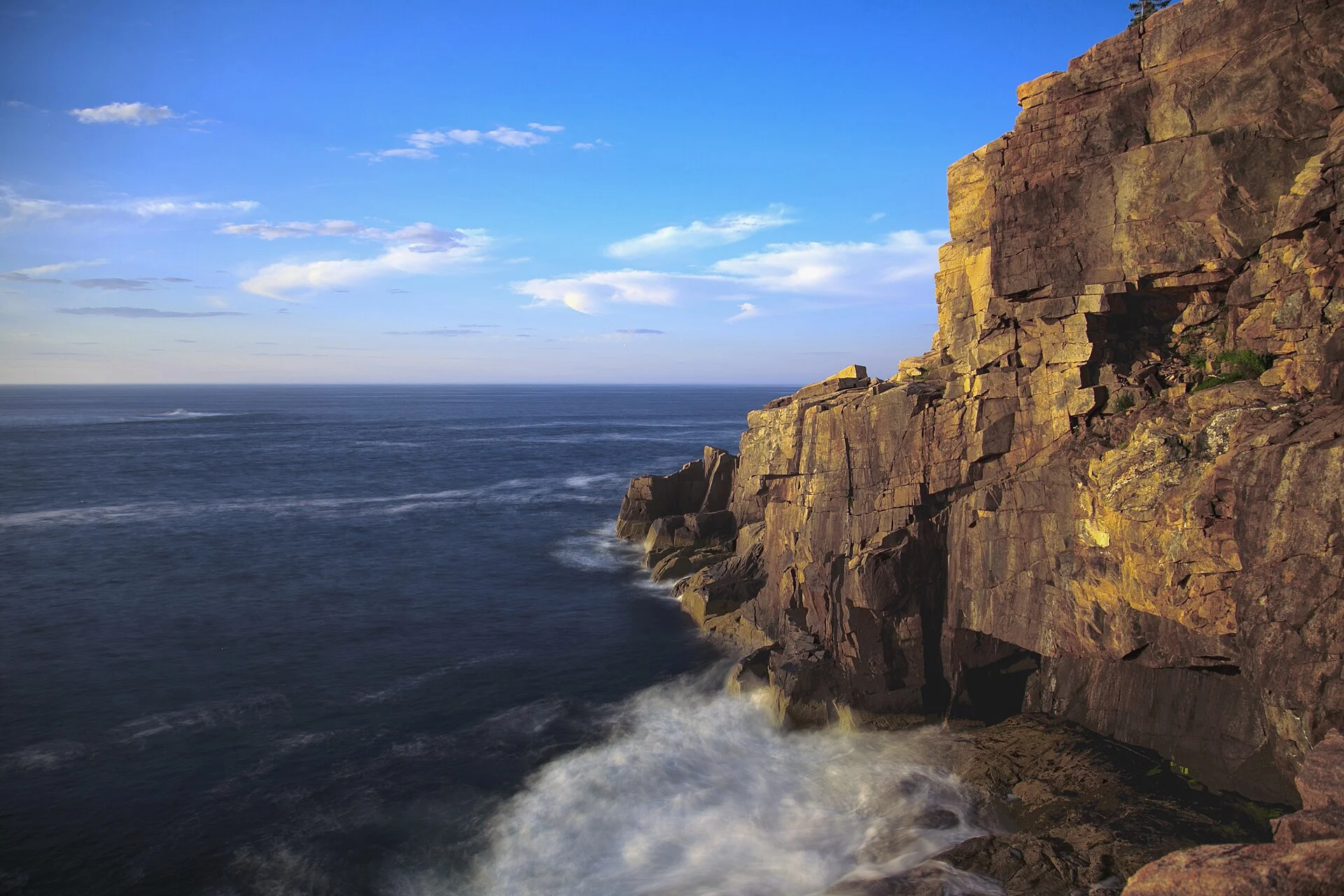
Acadia brings mountains, woodland and an exposed Atlantic shoreline into the same journey. Begin by choosing a specific area, not by treating the whole national park as a single attraction. The eastern side of Mount Desert Island offers Sand Beach, Thunder Hole and the Ocean Path; each can be a focus rather than a box to tick on an uninterrupted circuit.
The NPS describes different surfaces along Ocean Path: the section towards Thunder Hole differs from the rougher stretches and staircases beyond. Read the actual trail and accessibility descriptions for the segment you want, then check active alerts. Repairs or weather can change a route. This article does not promise that the entire trail is open or suitable for every visitor.
Stay on designated routes and back from cliff edges and wave-washed rock. A photograph made from a dramatic angle is not a route instruction. The Otter Cliff image shows the meeting of granite and sea in July 2016, with source color and exposure adjustments documented in its caption. Look for the same relationship in the landscape without trying to reproduce the photographer's position.
Change the scale at Jordan Pond
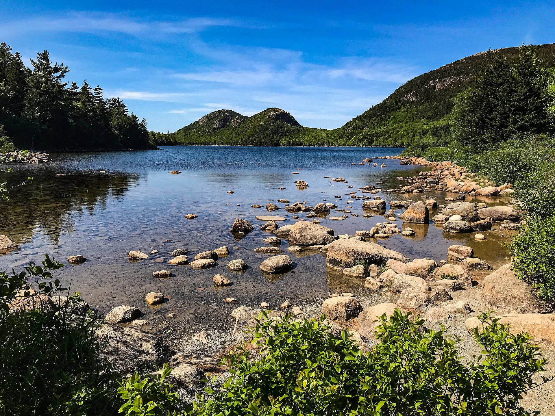
At Jordan Pond, turn your attention from the open Atlantic to a lake framed by wooded slopes and the rounded Bubbles. The scene is an invitation to look more slowly: foreground stones, the line of the opposite shore and the hills behind it. You do not need to complete a full circuit to appreciate that composition.
If you want the Jordan Pond Path, the NPS describes a 3.3-mile loop with uneven footing, boardwalks and rocks; the western half is more demanding. Do not assume a lakeside name means a level accessible walk. Choose a turnaround point or another viewing area if that better fits your group. Swimming and wading are prohibited because Jordan Pond supplies drinking water.
Separate the landscape from the restaurant visit. A photograph of a summer afternoon is not evidence that food service will be operating when you arrive. At the 28 October 2026 check, the published NPS seasonal table placed the Jordan Pond House restaurant's closing date on 26 October. Use the current official schedule for your actual trip; a future season needs its own check.
Choose Bass Harbor for the setting, not a sunset guarantee
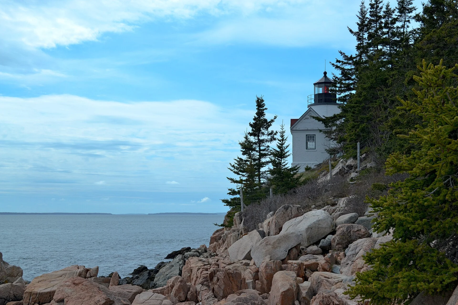
Bass Harbor Head Light Station sits on the southwest side of Mount Desert Island in Tremont. It makes a useful contrast with the taller, more open Portland Head Light setting. Here, the compact white tower and surrounding trees sit above a close rocky shoreline. The building's exterior and its place in the coast are the subject; the lighthouse interior is not open for ordinary public visiting.
The NPS warns about limited parking and congestion around sunset. Choose a time for the visit itself, not a promise of a clear sky or an empty photographic perch. Use designated viewing areas, observe parking restrictions and respect neighboring property. The accessible overlook and the stairway route to the cliff viewpoint are different experiences, so check the route that matches your needs.
Our May 2014 photograph predates later changes to the light. It records a real view of the station at that time rather than a claim about today's beacon equipment. An older image can explain why a setting is compelling while still leaving the present-day details to current interpretation and your own observation.
Plan Acadia around the season you will actually visit
A park entrance pass and a Cadillac Summit Road vehicle reservation solve different problems. At the 28 October 2026 check, the NPS reservation page listed 20 May–25 October for the 2026 Cadillac requirement. That published period had ended; it is not a schedule for the following year or a guarantee that the road will be open. Check the current dates, road conditions and applicable entrance-pass rules together.
Budget from the current NPS fee page for your party. Its 2026 information includes additional non-US resident fees and pass exceptions, so an old vehicle-only price may not represent your total. Follow the official guidance instead of relying on a single copied headline rate. A reservation, where required, also does not reserve a particular parking space.
The Island Explorer is seasonal. The operator's published 2026 calendar listed the main summer routes through 12 October, already past at this draft's check. Consult the operator for the dates and routes of your visit; do not build an October or winter plan around a summer timetable. Save useful maps and confirmations offline, and make sure the return journey works as well as the outward one.
Finally, read the place beyond its park boundary. Acadia is part of the enduring homeland of the Wabanaki, whose communities and cultures remain present. The NPS history and Wabanaki interpretation offer context that a sequence of scenic stops cannot supply. Allow room for that understanding alongside the coast's visual appeal.
Before you go
- Choose your overnight bases before adding coastal detours.
- Check official park alerts, individual trail descriptions and the return journey.
- Distinguish Acadia entrance passes from Cadillac vehicle reservations.
- Confirm non-US resident fees and applicable pass exceptions on the current NPS page.
- Check seasonal restaurant, campground and shuttle dates for your travel year.
- Keep to public routes, respect working waterfronts and pack out litter.
Your questions, answered
Can I see this whole Maine route in one day?
This is a choice of coastal bases, not a one-day driving schedule. For a short visit, select one area; for a longer trip, build in transfer time and keep optional detours separate from the main plan.
Does an Acadia pass include a Cadillac Summit Road reservation?
The entrance pass and the seasonal vehicle reservation are separate. Check the official reservation dates and applicable pass requirements for your travel year before planning a drive to the summit.
Is the Island Explorer available all year?
No. Island Explorer service is seasonal, and routes have their own operating dates. Consult the operator calendar rather than assuming a summer route will run during a late-autumn or winter visit.
About this story
This story completed TourPedia’s editorial and photograph checks before publication. Visiting arrangements can change; check current information before travelling.
Our editorial approach